![]()
![]()
LOCATION
Wah Cantonment is situated in Tehsil Taxila, District Rawalpindi. It is located 35 KM away from Rawalpindi towards North on G.T Road. Wah Cantonment is now bounded by a point near Sarai Kala Chowk in the South-
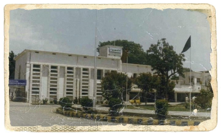
Evaluation of Wah Cantonment
Wah was declared as Cantonment in the year 1949. It included mainly POF Estate Areas and some private areas. In the year 1951 the Cantonment limits were extended thereby including villages such as Losar Sharfoo, Budho, Sukho Mehsian and Gudwal. The limits were later on further extended upto Margalla Hills in 1964 which included some areas now forming part of Taxila Cantonment and Taxila Municipal committee. These areas were subsequently excluded from the limits of Wah Cantt in 1976.
|
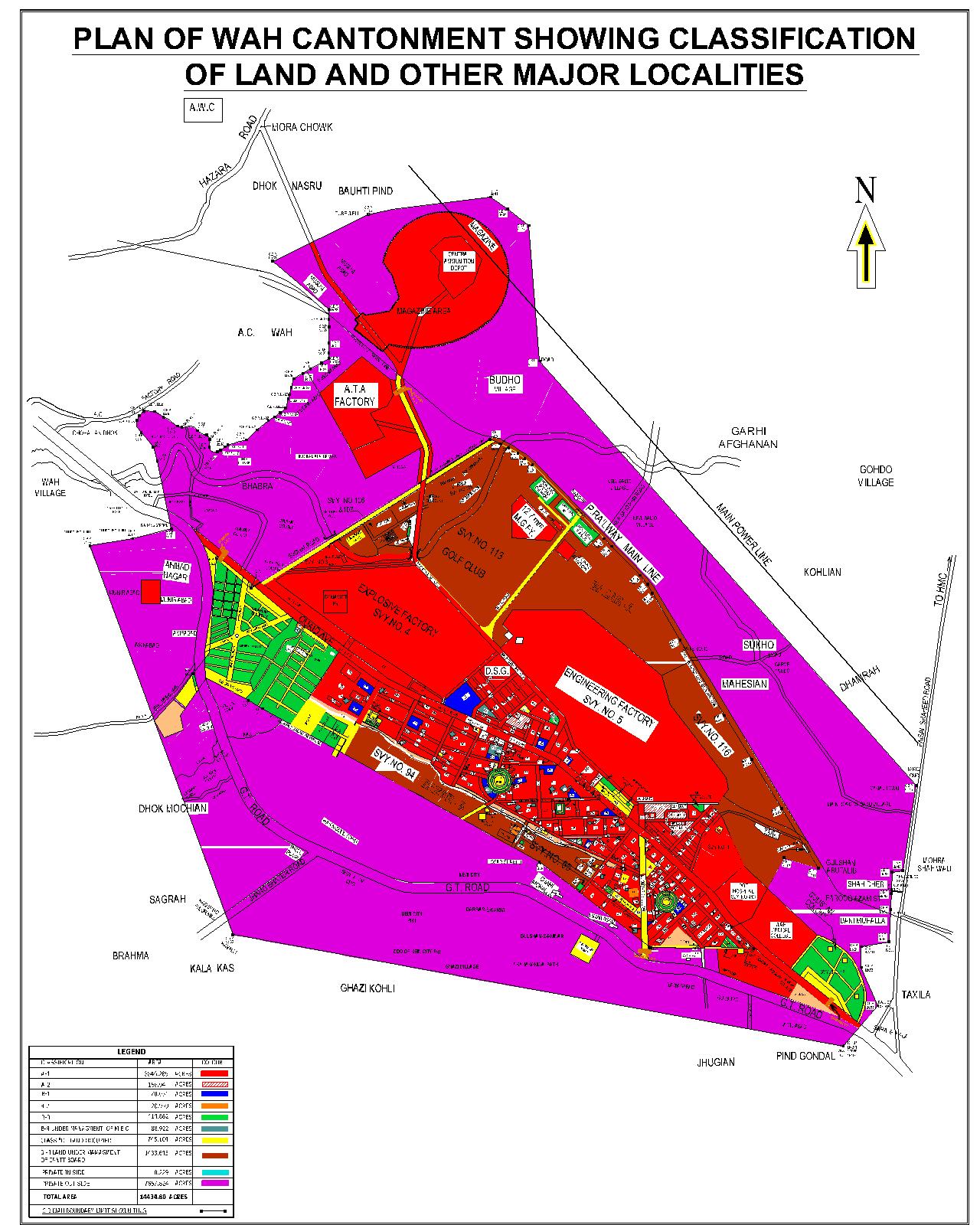
Classification |
Area (Acres) |
Usage |
Purpose |
|---|---|---|---|
|
A-1 |
3846.285 |
Units, Barracks, Lines, CMH, Offices, BOQs, MOQs, OR lines, JCO Lines, etc. |
Land in the active occupation of the Army |
|
A-2 |
156.094 |
Open land |
Vacant Military Land for specific purpose. |
|
B-1 |
70.051 |
Post Office, PO Colony, T&T Communication Building & Railway Administration. |
Land which is occupied or used by the federal government except Ministry of Defence |
|
B-2 |
20.939 |
Provincial Govt land. |
Land which is occupied or used by the provincial government. |
|
B-3 |
414.862 |
Land leased out to private persons |
Leased land which is held by any private person. |
|
B-4 (MEO) |
88.922 |
|
|
|
B-4 (CBW) |
1433.645 |
Graveyard, Drains and Nullahs etc. |
Vacant land which has not leased out to any one |
|
C |
745.104 |
Roads, Public Parks, Quarters etc |
Land which is vested in the Board. |
| Private Land | 7658.053 | ||
| Total | 14434.800 |
|
Population of Wah Cantonment |
3,80,103 |
|---|---|
|
Bazar Area |
2537.41 Acres |
|
Parks |
17 Nos. |
|
Grave Yard |
03 No |
|
Length of Roads |
82.23 K.M |
|
Roads (Maitained by CB) |
113.20 K.M |
|
Roads (Maitained by POF) |
165.00 K.M |
|
Roads (Maitained by Prov: Govt) |
10.00 K.M |
|
Tube Wells |
15 Nos. |
|
Over Head Water Tank |
04 Nos. |
| Water Purification Plants |
21 Nos. |
|
Water Supply Network |
229,658 RFT |
|
Street Lights |
00 |
|
CB Public Girls School & College |
03 Nos |
|
Despensory |
03 Nos |
|
Library |
02 No |
|
Reading Room |
03 No |